Despite the considerable progress that has been made over the last 19 years in bringing decent shelter and basic services to communities, it is fair to say that the apartheid-bequeathed spatial inequalities and settlement distortions remain as scars on the urban landscape.
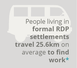
Some of these distortions have been exacerbated by poor state-led housing policies, as well as weak public-sector strategic spatial planning that has allowed the private production of space in unsustainable forms (such as artificially separated lifestyle estates and incongruously located office parks and retail centres) on the urban periphery. A fragmented public transport system, and the drift of jobs away from mining and industry to tertiary activities almost always located far from townships, has compounded spatial dislocations, and in turn poverty and inequality.
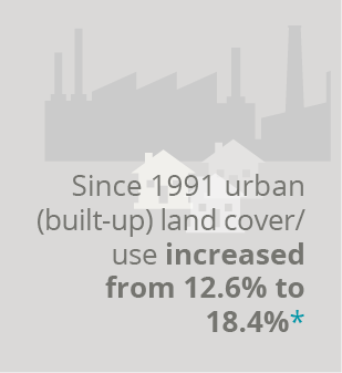
The space and mobility section describes where people are located in the GCR and the drastic land cover/use change and urban growth over the past 2 decades. It explores the legacy of fragmented human settlement and delves into housing development trends and the ‘housing, land-use and transport’ relationship.